Nationalen Forum für Fernerkundung und Copernicus 2017
|
|
|
- Gerburg Baum
- vor 6 Jahren
- Abrufe
Transkript

 Möglichkeiten und Grenzen von")

1 Nationalen Forum für Fernerkundung und Copernicus 2017 Zugang zu Copernicus Daten und Produkten in Nahe Echtzeit Egbert Schwarz Deutsches Zentrum für Luft und Raumfahrt (DLR) Deutsches Fernerkundungsdatenzentrum (DFD) Möglichkeiten und Grenzen von marinen Copernicus- Daten für Wirtschaft, Wissenschaft und Behörden Nationalen Forum für Fernerkundung und Copernicus 2017 Berlin, 14. März 2017
 6 Days repeat cycle (S1A+S1B) - Strip Map Mode (SM): 80 km swath width,")
: 400 km swath width, 25 x 100 m spatial resolution - Wave-Mode (WV): 20 km x 20 km, 5 x 20 m spatial")
2 Copernicus Mission Sentinel-1 Sentinel-1A and Sentinel-1B operational Orbit Type: Sun-synchronous, near-polar, circular Orbit Height: 693 km C-band Synthetic Aperture Radar (SAR) 6 Days repeat cycle (S1A+S1B) - Strip Map Mode (SM): 80 km swath width, 5 x 5 m spatial resolution - Interferometric Wide Swath (IW): 250 km swath width, 5 x 20 m spatial resolution - Extra-Wide Swath Mode (EW): 400 km swath width, 25 x 100 m spatial resolution - Wave-Mode (WV): 20 km x 20 km, 5 x 20 m spatial resolution

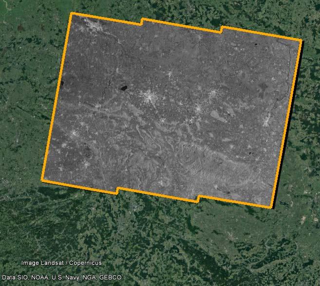
3 Sentinel-1 Observation Scenario source:


4 COPERNICUS - Collaborative Ground Segment Copernicus Core Ground Segment and Services National Collaborative Ground Segment Direct Downlink Local Ground Station Copernicus Service Entities CGS MPC circulation PAC network CQC POD EO Data Users Exploitation Entities and Cloud Providers Copernicus Data Access and Exploitation Collaborative Infrastructure Portals Data and Product Access Archive Ingestion Information Systems & Services Processing dissemination network Sentinel Core PDGS Data Hub Acquisition Station, EDRS Third Party Data


5 Copernicus Locale Ground Station Local Ground Station (LGS) as part of the DLR Copernicus Collaborative Ground Segment New 11.5 meter antenna system operational since spring 2017 VM Ware cluster solution for processing Direct Downlink and NRT processing Ground Station Neustrelitz, elevation mask for Sentinel-1, 5 degree elevation
6 Copernicus Mission Sentinel-1 Sentinel-1A and Sentinel-1B operational Orbit Type: Sun-synchronous, near-polar, circular Orbit Height: 693 km C-band Synthetic Aperture Radar (SAR) 6 Days repeat cycle (S1A+S1B) - Strip Map Mode (SM): 80 km swath width, 5 x 5 m spatial resolution - Interferometric Wide Swath (IW): 250 km swath width, 5 x 20 m spatial resolution - Extra-Wide Swath Mode (EW): 400 km swath width, 25 x 100 m spatial resolution - Wave-Mode (WV): 20 km x 20 km, 5 x 20 m spatial resolution


7 Sentinel-1 DLR Downlink and Processing Overview

8 Acquisition Plan Example: Porject Echtzeitdiesnte Maritime Sicherheit - Security Project EMSec Project Flood mapping Project Ground Motion Project Flood mapping
, even only")


9 Acquisition Plan issues Acquisition should cover the region of interest (ROI), even only parts High priority Acquisition should cover at least 50% of the ROI Slicing according the ROI High priority Acquisition should cover exact 100% ROI Slice merge and clipping requested Low priority

10 Baseline: ESA High Level Operations Plan S1A und S1B Acquisition Segments KML von der ESA Example: Europe only


11 Acquisition Plan Example: Porject Echtzeitdiesnte Maritime Sicherheit - Security EMSec

12 Acquisition Plan Example: Porject Echtzeitdiesnte Maritime Sicherheit - Security STATION_DOWNLINK_PLAN for Neustrelitz provided by ESA contains the Datatakes, planned in Direct Downlink Mode Examle: Datatake 7f6a
13 Ground Station Acquisition Plan DATE SAT STN REVN MAX.ELE AOS LOS OPRN S1B NSG :13:57 06:14:24 HIGH ZKI flood UK S1B NSG :24:19 17:25:26 LOW EMSec S1B NSG :15:35 05:16:39 LOW EMSec S1B NSG :21:49 04:22:09 HIGH ZKI flood S1B NSG :56:24 05:57:28 LOW EMSec S1B NSG :07:00 16:07:22 HIGH ZKI flood S1B NSG :39:55 05:41:11 LOW EMSec,Hannover S1B NSG :51:31 16:52:38 LOW EMSec S1B NSG :22:07 06:22:36 HIGH ZKI flood UK S1B NSG :23:50 05:24:48 LOW EMSec Generation once per week (Wednesday), one week in advance Only in case ESA planning infomation available for the whole planning cycle Fully automated based on order subscription requirements
14 Ground Station Acquisition Plan Future Plans: subscription on CODE DE / Datahub to include data takes not available in direct downlink mode Use DLR solution scene2time instead of ESA kml Support Emergency Planning
 - L1 GHRD + Level 2 processing - Ship Detection - Wind - Wave in progress - Flood - Dissemination - Delivery server - Web-Client -")
15 Sentinel-1 Products available - L1 GRHD + value adding Quicklook, L2 processing speared (ZKI, Food) - L1 SLC single slice, same coverage (Ground Motion Service Germany) - L1 GHRD + Level 2 processing - Ship Detection - Wind - Wave in progress - Flood - Dissemination - Delivery server - Web-Client -


16 Example: Ground Motion Service Germany
 Level 2 Produktformate Image:")
17 Example for Wind field products based on Sentinel-1 Core function is the CMOD-5 algorithm developed by the Maritime Security Lab Bremen to derive wind speed and direction, Forecast model is implemented to provide wind direction, the netcdf output is generated, containing the wind direction and intensity (WD10) Level 2 Produktformate Image: S1A_IW_GRDH_1SDV_ T035101_ T DLR SAR WIND product (rectangles) derived from the Sentinel image, wind forecast and Level 1 quicklook product as background (Google Earth) ASCII netcdf Google (KMZ) png, wld, png.aux.xml ESRI Shape Layer Files (shape)
 png, wld, png.aux.")
18 Example for Wave product based on Sentinel-1 Core function is the CWAVE algorithm developed by the Maritime Security Lab Bremen to derive wind speed and direction, Level 2 Produktformate ASCII netcdf Google (KMZ) png, wld, png.aux.xml ESRI Shape Layer Files (shape) Image: S1B_IW_GRDH_1SDV_ T053133_ T DLR SAR WAVE product (rectangles) derived from the Sentinel image, wind forecast and Level 1 quicklook product as background (Google Earth)

19 Example for Sentinel-1 Wind product, provided via geoserver and visualised on Web-mapping client


20 COPERNICUS - Collaborative Ground Segment Copernicus Core Ground Segment and Services National Collaborative Ground Segment CODE-DE Copernicus Service Entities EO Data Users Exploitation Entities and Cloud Providers Copernicus Data Access and Exploitation Collaborative Infrastructure CGS MPC circulation network CQC POD dissemination network PAC Data Hub Portals Data and Product Access Archive Ingestion Information Systems & Services Processing Sentinel Core PDGS Acquisition Station, EDRS Third Party Data
21 CODE-DE: Copernicus Data and Exploitation Platform Finanziert durch das BMVI Projektdauer: Drei Phasen Datenzugang ab: Q4/2016 Datenzugang und Initialisierung der Prozessierung: Q1/ Q2/2017 Operationeller Betrieb: Q3/ Finanziert durch das BMVI
22 CODE-DE: Copernicus Data and Exploitation Platform Zugang CODE-DE Such- und Darstellungsdienst (Open Search) Selbstregistrierung für Data Access und Download Limitierte Anzahl an Power Usern mit kostenfreiem Zugang Skalierbarer Ansatz für zusätzliche (kostenpflichtige) Prozessierung Steuerung durch DLR Raumfahrtmanagement Finanziert durch das BMVI

23 CODE-DE: Copernicus Data and Exploitation Platform Priorisierung Nutzer: Bundesbehörden. Dazu gehören Mitarbeiter von Bundesbehörden und Forschungseinrichtungen des Bundes sowie deren Auftragnehmer, die im Rahmen eines Auftrags für eine Bundesbehörde CODE-DE nutzen. Diese Nutzerkategorie ist die primäre Zielgruppe von CODE-DE. (Prio 1) Nutzer aus Deutschland. Dazu gehören Mitarbeiter sonstiger deutscher Behörden (Prio 2), Unternehmen (Prio 3), Forschungs- und Bildungseinrichtungen (Prio 3), NGO (Prio 3) oder Bürger (Prio 3) Sonstige Nutzer. Dazu gehören alle Nutzer, die nicht in eine der anderen Nutzerkategorien fallen, d.h. primär Nutzern, die nicht aus Deutschland stammen. (Prio 4) Background Nutzung durch CODE-DE intern (e.g. Global Base Map) Weitere Nutzer (Sonderregelungen) Governance Modell in Vorbereitung

24 Egbert Scwarz German Aerospace Center (DLR) German Remote Sensing Data Center (DFD) Kalkhorstweg Neustrelitz Phone: 03981/ Fax: 03981/ Sentinel-1A :23 Level 1 IW GRD
Nationalen Forum für Fernerkundung und Copernicus 2017
 Nationalen Forum für Fernerkundung und Copernicus 2017 Zugang zu Copernicus Daten und Produkten Egbert Schwarz Deutsches Zentrum für Luft und Raumfahrt (DLR) Deutsches Fernerkundungsdatenzentrum (DFD)
Near Real Time - SAR basierte Anwendungen im maritimen Bereich
 GeoForum MV 2011 Near Real Time - SAR basierte Anwendungen im maritimen Bereich Matthias Berg, Susanne Lehner, Stephan Brusch, Egbert Schwarz DLR Cluster Angewandte Fernerkundung Inhalt Übersicht Synthetic
Copernicus Data Access and Exploitation Collaborative Infrastructure COPACI
 www.dlr.de Folie 1 Copernicus Data Access and Exploitation Collaborative Infrastructure COPACI Konzept und Status 06. März 2014 Bonn-Oberkassel www.dlr.de Folie 2 Copernicus wird Wirklichkeit EU Copernicus
GMES-Echtzeitdienste: Anforderungen an die Bodenempfangsstation und das Datenmanagement
 GMES-Echtzeitdienste: Anforderungen an die Bodenempfangsstation und das Datenmanagement H. Maass, E. Schwarz, S. Lehner* Nationales Bodensegment Deutsches Fernerkundungsdatenzentrum (DFD) * Institut für
Applying Pléiades in the ASAP project HighSens
 Applying Pléiades in the ASAP project HighSens Highly versatile, new satellite Sensor applications for the Austrian market and International Development (Contract number: 833435) Dr. Eva Haas, GeoVille
CODE-DE Copernicus Data and Exploitation Platform Deutschland - Tools/Prozessierung, Projekte und Produkte - Das CODE-DE Team
 CODE-DE Copernicus Data and Exploitation Platform Deutschland - Tools/Prozessierung, Projekte und Produkte - Das CODE-DE Team * Ziele von CODE-DE nach März 2017 CODE-DE soll Nutzern in Deutschland Behörden,
Aktuelle und zukünftige Entwicklungen zur Nutzung von Sentinel-Daten für das Katastrophenmanagement
 Aktuelle und zukünftige Entwicklungen zur Nutzung von Sentinel-Daten für das Katastrophenmanagement Impulsvortrag Prof. Dr. Günter Strunz Erdbeobachtungszentrum (EOC) Deutsches Zentrum für Luft- und Raumfahrt
Use of ALOS-PALSAR for Oceanography
 Use of ALOS-PALSAR for Oceanography Remote Sensing Technology Institute German Aerospace Agency, DLR-Germany S.Lehner, S.Brusch, Li XiaoMing, T. König SAR Oceanography Algorithms SAR Processor Wind Field
FFG Austrian Research Promotion Agency Agentur für Luft- und Raumfahrt
 FFG Austrian Research Promotion Agency GMES - Eine Chance für Österreichs Forschung und Industrie H. Posch 5 Dezember 2006 GMES - Hauptelemente Space Component wird unter ESA Verantwortung abgewickelt
Using TerraSAR-X data for mapping of damages in forests caused by the pine sawfly (Dprion pini) Dr. Klaus MARTIN klaus.martin@slu-web.
 Dr. Klaus MARTIN klaus.martin@slu-web.") Using TerraSAR-X data for mapping of damages in forests caused by the pine sawfly (Dprion pini) Dr. Klaus MARTIN klaus.martin@slu-web.de Damages caused by Diprion pini Endangered Pine Regions in Germany
Using TerraSAR-X data for mapping of damages in forests caused by the pine sawfly (Dprion pini) Dr. Klaus MARTIN klaus.martin@slu-web.de Damages caused by Diprion pini Endangered Pine Regions in Germany
Remote Sensing Products for Environmental Assessment at Offshore Platforms and Pipelines
 Remote Sensing Products for Environmental Assessment at Offshore Platforms and Pipelines Susanne Lehner, Thomas König Domenico Velotto, Stephan Brusch German Aerospace Center (DLR) Remote Sensing Technology
 3D City Model Berlin Spatial Data Infrastructure Berlin: The 3D City Model ERDF Project Strategic Goal 3D City Model Berlin Strategic Goal Use of 3D City Model for: City and Urban Planning, Political Issues
Das Copernicus Sentinel Satellitenprogramm. Neue Anwendungsmöglichkeiten für die Erdbeobachtung
 Das Copernicus Sentinel Satellitenprogramm Neue Anwendungsmöglichkeiten für die Erdbeobachtung Prof. Dr. Günter Strunz Deutsches Zentrum für Luft- und Raumfahrt (DLR) Oberpfaffenhofen Vortrag im Rahmen
DEMMIN. Durable Environmental Multidisciplinary Monitoring Information Network
 DEMMIN Durable Environmental Multidisciplinary Monitoring Information Network German Aerospace Center (DLR) German Remote Sensing Data Center (DFD) Department of Ground Segment (BN) Folie 1 Neustrelitz
Aktuelle Anwendung von Fernerkundungsdaten
 Literaturhinweis: ALBERTZ, Jörg (2007): Einführung in die Fernerkundung, Grundlagen der Interpretation von Luft- und Satellitenbildern, 3. Auflage, Wisssenschaftliche Buchgemeinschaft Darmstadt Grundlagen
Extraction of Wind and Wave Field from SAR data
 Extraction of Wind and Wave Field from SAR data S. Lehner, X. Li, Th. Bruns, W. Rosenthal German Aerospace Center (DLR), Oberpfaffenhofen Motivation Derive integrated Wave Parameters (e.g. SWH, mean period)
Europäische Aktivitäten in der Erdbeobachtung
 Europäische Aktivitäten in der Erdbeobachtung Portfolio der FFG/ALR Dr. Thomas Geist 1. Juli 2014 IKT der Zukunft 2014 Workshop EO Thomas Geist Angewandte Fernerkundung WS 2010/2011 ESA EO Aktivitäten
Copernicus Data and Exploitation Platform Deutschland - Eine Nationale Fernerkundungsplattform -
 Copernicus Data and Exploitation Platform Deutschland - Eine Nationale Fernerkundungsplattform - Das CODE-DE Team Erstellt von A. Müller und V. Keuck (DLR) Schulung 16.03.2017 (T. Kukuk & A. Klaus, GAF
Browser- gestützte Visualisierung komplexer Datensätze: Das ROAD System
 AG Computeranwendungen und QuanLtaLve Methoden in der Archäologie 5. Workshop Tübingen 14. 15. Februar 2014 Browser- gestützte Visualisierung komplexer Datensätze: Das ROAD System Volker Hochschild, Michael
DROHNENTECHNOLOGIE UND ANWENDUNGEN. Prof. Dr. Wolfram Hardt Dr. Ariane Heller, Dipl.-Inf. Stephan Blokzyl
 DROHNENTECHNOLOGIE UND Prof. Dr. Wolfram Hardt ANWENDUNGEN Prof. Dr. Wolfram Hardt Dr. Ariane Heller, Dipl.-Inf. Stephan Blokzyl Today Mobility reaches 3 rd Dimension Quelle: COPTERview airdata UG Individuality
Webbasierte Exploration von großen 3D-Stadtmodellen mit dem 3DCityDB Webclient
 Webbasierte Exploration von großen 3D-Stadtmodellen mit dem 3DCityDB Webclient Zhihang Yao, Kanishk Chaturvedi, Thomas H. Kolbe Lehrstuhl für Geoinformatik www.gis.bgu.tum.de 11/14/2015 Webbasierte Exploration
Nationaler Informationstag 25. Mai 2011 in Bonn Kurzvorstellung der Kompetenzen von der Hochschule Bremen Kleinsatelliten, Prof.
 Nationaler Informationstag 25. Mai 2011 in Bonn Kurzvorstellung der Kompetenzen von der Hochschule Bremen Kleinsatelliten, Prof. Kalnins Hinsichtlich der 5. Raumfahrt-Ausschreibung Satellitenprojekte (2000
JONATHAN JONA WISLER WHD.global
 JONATHAN WISLER JONATHAN WISLER WHD.global CLOUD IS THE FUTURE By 2014, the personal cloud will replace the personal computer at the center of users' digital lives Gartner CLOUD TYPES SaaS IaaS PaaS
POLDIRAD Measurements
 POLDIRAD Measurements Martin Hagen and Hartmut Höller Jens Reimann, Lothar Oswald, Hermann Scheffold, DLR Oberpfaffenhofen Polarization Doppler Radar POLDIRAD 1986 installed as the first fully polarimetric
Meteorological measurements at the Offshore Platform FINO 2 - new insights -
 FINO 2011 Conference May 11 th 2011, Hamburg, Germany Meteorological measurements at the Offshore Platform FINO 2 - new insights - Dipl.-Geoök. Stefan Müller, Dipl.-Ing Joachim Schwabe Content 1. FINO
XONTRO Newsletter. Financial Institutes. No. 70
 XONTRO Newsletter Financial Institutes No. 70 Page 1 This XONTRO Newsletter for Financial Institutes contains information covering the following topics: BCIN BV processing control handling ( Bearbeitung
Climate change and availability of water resources for Lima
 Climate change and availability of water resources for Lima András Bárdossy bardossy@iws.uni-stuttgart.de Lima Marzo 12. 2009 1 Engineers and the future Knowledge about Past Design for Future Lima Marzo
SARA 1. Project Meeting
 SARA 1. Project Meeting Energy Concepts, BMS and Monitoring Integration of Simulation Assisted Control Systems for Innovative Energy Devices Prof. Dr. Ursula Eicker Dr. Jürgen Schumacher Dirk Pietruschka,
TMF projects on IT infrastructure for clinical research
 Welcome! TMF projects on IT infrastructure for clinical research R. Speer Telematikplattform für Medizinische Forschungsnetze (TMF) e.v. Berlin Telematikplattform für Medizinische Forschungsnetze (TMF)
ISEA RWTH Aachen Electric Bus Simulation
 ISEA RWTH Aachen Electric Bus Simulation Finding the Optimal Technical Configuration 05.04.2017 Fabian Meishner Lehrstuhl für Elektrochemische Energiewandlung und 1 Speichersystemtechnik Electric Bus Simulation
Level of service estimation at traffic signals based on innovative traffic data services and collection techniques
 Level of service estimation at traffic signals based on innovative traffic data services and collection techniques Authors: Steffen Axer, Jannis Rohde, Bernhard Friedrich Network-wide LOS estimation at
Satellitendaten auf der ArcGIS Plattform von Esri Content und Marketplace für Kunden und Endnutzer
 Satellitendaten auf der ArcGIS Plattform von Esri Content und Marketplace für Kunden und Endnutzer Dr. A. Carstens Esri Deutschland GmbH Berlin, 5.11.2015 ArcGIS Plattform ArcGIS Plattform Fachanwender
Cisco Borderless Networks Sicherheit und Energieeffizienz im Netzwerk von heute. Mathias Wietrychowski, Sr. Systems Engineer Manager
 Cisco Borderless Networks Sicherheit und Energieeffizienz im Netzwerk von heute Mathias Wietrychowski, Sr. Systems Engineer Manager Mobilität ist der neue Meilenstein in der IT Mini PC Networked PC Internet
ERDBEOBACHTUNG UND CLOUD. Das Wissen von Morgen. Dr. Wolfgang Steinborn DLR-Raumfahrtmanagement in Bonn - Erd-Monitoring Anwendungen & Netzwerke
 www.dlr.de Folie 1 EO & Cloud W.Steinborn / DLR AIR InGeoForum, Bonn 07/02/14 ERDBEOBACHTUNG UND CLOUD Das Wissen von Morgen Dr. Wolfgang Steinborn DLR-Raumfahrtmanagement in Bonn - Erd-Monitoring Anwendungen
GridMate The Grid Matlab Extension
 GridMate The Grid Matlab Extension Forschungszentrum Karlsruhe, Institute for Data Processing and Electronics T. Jejkal, R. Stotzka, M. Sutter, H. Gemmeke 1 What is the Motivation? Graphical development
Building the European Biodiversity Observation Network (EU BON)
") Building the European Biodiversity Observation Network (EU BON) Aufbau eines Europäischen Netzwerkes für Biodiversitätsinformation Anke Hoffmann & Christoph L. Häuser Museum für Naturkunde - Leibniz Institute
Building the European Biodiversity Observation Network (EU BON) Aufbau eines Europäischen Netzwerkes für Biodiversitätsinformation Anke Hoffmann & Christoph L. Häuser Museum für Naturkunde - Leibniz Institute
Data Mining and Data Analysis using the Example of cross-border Traffic Management during Extreme Weather Events
 Data Mining and Data Analysis using the Example of cross-border Traffic Management during Extreme Weather Events Dipl.-Ing. Marc Hohloch Extreme Weather Events and the Impact for Mobility of Rescue Forces
HIR Method & Tools for Fit Gap analysis
 HIR Method & Tools for Fit Gap analysis Based on a Powermax APML example 1 Base for all: The Processes HIR-Method for Template Checks, Fit Gap-Analysis, Change-, Quality- & Risk- Management etc. Main processes
Austria Regional Kick-off
 Austria Regional Kick-off Andreas Dippelhofer Anwendungszentrum GmbH Oberpfaffenhofen (AZO) AZO Main Initiatives Andreas Dippelhofer 2 The Competition SPOT THE SPACE RELATION IN YOUR BUSINESS 3 Global
WP2. Communication and Dissemination. Wirtschafts- und Wissenschaftsförderung im Freistaat Thüringen
 WP2 Communication and Dissemination Europa Programm Center Im Freistaat Thüringen In Trägerschaft des TIAW e. V. 1 GOALS for WP2: Knowledge information about CHAMPIONS and its content Direct communication
Regionale Reanalysen
 Regionale Reanalysen Frank Kaspar mit Beiträgen von Andrea Kaiser-Weiss, Michael Borsche (DWD) sowie dem Hans-Ertel-Zentrum für Wetterforschung Teilbereich Klimamonitoring, Universität Bonn the Climate
NEREUS Workshop Maritime Security
 SAR Maritime Applications Maritime Security and Safety Lab Forschungsstelle Maritime Sicherheit DLR BF IMF OP DLR Bremen Flughafen, Institut für Methodik der Fernerkundung, Oberpfaffenhofen NEREUS Workshop
TerraSAR and German Contributions to the GMES Programme
 TerraSAR and German Contributions to the GMES Programme Gunter Schreier Business Development and GMES Coordination DLR German Remote Sensing Data Center The German Aerospace Center (DLR) Largest R&D institution
Possible Contributions to Subtask B Quality Procedure
 Possible Contributions to Subtask B Quality Procedure aeteba - Energy Systems, Germany Elmar Sporer zafh.net Stuttgart, Germany Dr. Dirk Pietruschka 1/14 aeteba - Consortium of different companies - Turnkey
Cloud Computing in der öffentlichen Verwaltung
 Cloud Computing in der öffentlichen Verwaltung Willy Müller - Open Cloud Day 19.6.2012 2 Plug and Cloud? 3 The plug tower BPaaS Software SaaS Platform PaaS Storage/ Computing IaaS Internet Power grid 4
Subsysteme: Software für Satellitensysteme
 Subsysteme: Software für Satellitensysteme B. Brünjes DLR Raumfahrtindustrietage, Bremen, 12./13. Juni 2008 Schwerpunkte der Softwareentwicklung bei OHB On-board Software für Satelliten Bodenkontroll-Software
OPUS-GMES. Thomas Esch Deutsches Zentrum für Luft- und Raumfahrt e.v. (DLR) Deutsches Fernerkundungsdatenzentrum (DFD) Abteilung Landoberfläche (LAX)
 Deutsches Fernerkundungsdatenzentrum (DFD) Abteilung Landoberfläche (LAX)") Konzept einer Plattform zur operationellen Bereitstellung und Verarbeitung von Sentinel-Datenströmen in Unterstützung von Copernicus-Geoinformationsdiensten Thomas Esch Deutsches Zentrum für Luft- und
Konzept einer Plattform zur operationellen Bereitstellung und Verarbeitung von Sentinel-Datenströmen in Unterstützung von Copernicus-Geoinformationsdiensten Thomas Esch Deutsches Zentrum für Luft- und
Open Source. Legal Dos, Don ts and Maybes. openlaws Open Source Workshop 26 June 2015, Federal Chancellery Vienna
 Open Source Legal Dos, Don ts and Maybes openlaws Open Source Workshop 26 June 2015, Federal Chancellery Vienna 1 2 3 A Case + vs cooperation since 2003 lawsuit initiated 2008 for violation of i.a. GPL
Aufbau eines IT-Servicekataloges am Fallbeispiel einer Schweizer Bank
 SwissICT 2011 am Fallbeispiel einer Schweizer Bank Fritz Kleiner, fritz.kleiner@futureways.ch future ways Agenda Begriffsklärung Funktionen und Aspekte eines IT-Servicekataloges Fallbeispiel eines IT-Servicekataloges
A parameterised 3D-Structure-Model for the state of Bremen (Germany)
") A parameterised 3D-Structure-Model for the state of Bremen (Germany) An application for detailled groundwater flow and transport studies Bremen Geography and Geology 3 Bremen Geography and Geology 4 Structual
A parameterised 3D-Structure-Model for the state of Bremen (Germany) An application for detailled groundwater flow and transport studies Bremen Geography and Geology 3 Bremen Geography and Geology 4 Structual
Determination of tornado intensity from forest damage
 Determination of tornado intensity from forest damage Veronika Beck 1,2, Nikolai Dotzek 2, Robert Sausen 2 1 Physik-Department,, Garching, Germany 2 DLR-Institut für Physik der Atmosphäre, Oberpfaffenhofen,
GMES Aktueller Status
 GMES Aktueller Status AHORN 2011 Imst 17. November 2011 Dr. Thomas Geist Global Monitoring for Environment and Security Was ist GMES? Was ist der aktuelle Status und wie geht es weiter? Was sind die GMES
TRAVEL AND HOTEL INFORMATION
 15th Annual Meeting of the Biofeedback Foundation of Europe February 22-26, 2011, Munich, Germany TRAVEL AND HOTEL INFORMATION Conference location Hochschule München: Fakultät Elektrotechnik und Informationstechnik
Symbio system requirements. Version 5.1
 Symbio system requirements Version 5.1 From: January 2016 2016 Ploetz + Zeller GmbH Symbio system requirements 2 Content 1 Symbio Web... 3 1.1 Overview... 3 1.1.1 Single server installation... 3 1.1.2
Novell for Education. Beratung - Systembetreuung - Supporting Implementation von Ausbildungsschienen für österreichische Schulen
 Novell for Education 08.10.2007 Wolfgang Bodei / Thomas Beidl Folie 1 The Goal of n4e is an effective increase of quality in terms of Design Operation Administration of Novell based school network infrastructures
Operational and technical testing of the European Train Control System (ETCS)
") Operational and technical testing of the European Train Control System (ETCS) Lars Ebrecht International Conference on Railway Technology - Railways 2012 18-20 April 2012 Vortragstitel > 24. April 2012
Operational and technical testing of the European Train Control System (ETCS) Lars Ebrecht International Conference on Railway Technology - Railways 2012 18-20 April 2012 Vortragstitel > 24. April 2012
TalkIT: Internet Communities Tiroler Zukunftsstiftung Donnerstag, 22. 4. 2010
 TalkIT: Internet Communities Tiroler Zukunftsstiftung Donnerstag, 22. 4. 2010 Reinhard Bernsteiner MCiT Management, Communication & IT MCI MANAGEMENT CENTER INNSBRUCK Universitätsstraße 15 www.mci.edu
Copernicus auf Kurs Möglichkeiten der Copernicus-Daten und -Dienste. Dr. Ralf Gehrke
 Copernicus auf Kurs Möglichkeiten der Copernicus-Daten und -Dienste Dr. Ralf Gehrke Gliederung BKG Copernicus Programm Weltraumkomponente Landüberwachung mit Copernicus Ralf Gehrke Copernicus auf Kurs
Possible Solutions for Development of Multilevel Pension System in the Republic of Azerbaijan
 Possible Solutions for Development of Multilevel Pension System in the Republic of Azerbaijan by Prof. Dr. Heinz-Dietrich Steinmeyer Introduction Multi-level pension systems Different approaches Different
Cloud und Big Data als Sprungbrett in die vernetzte Zukunft am Beispiel Viessmann
 Cloud und Big Data als Sprungbrett in die vernetzte Zukunft am Beispiel Viessmann Adam Stambulski Project Manager Viessmann R&D Center Wroclaw Dr. Moritz Gomm Business Development Manager Zühlke Engineering
TECHNISCHE HERAUSFORDERUNGEN UND ANSÄTZE DER NUTZUNG VON SENTINEL-DATEN CARSTEN BROCKMANN, MARTIN BOETTCHER BROCKMANN CONSULT GMBH
 TECHNISCHE HERAUSFORDERUNGEN UND ANSÄTZE DER NUTZUNG VON SENTINEL-DATEN CARSTEN BROCKMANN, MARTIN BOETTCHER BROCKMANN CONSULT GMBH BROCKMANN CONSULT Gegr. 1999, Geesthacht bei Hamburg 28 Mitarbeiter davon
Copernicus Land Monitoring Service Title
 Copernicus Land Monitoring Service Title Tobias LANGANKE First name SURNAME Project manager, Copernicus Position land services European Name of the Environment entity Agency Place, Fachworkshop: date Die
Overview of the Munich Noise Protection Policies
 Overview of the Munich Noise Protection Policies Working Group Noise Eurocities Munich/Planegg 14/15 September 2016 Dieter Kemmather City of Munich Department of Health and Environment Contents 1. Introduction
From Mapping to Metadata, From Simple to Enterprise Portals? - A one Stop Solution using Portlet Technology*
 From Mapping to Metadata, From Simple to? - A one Stop Solution using Portlet Technology* (* for download images have been compressed; quality decreased) Hans Plum plum@lat-lon.de www.lat-lon.de www.deegree.org
EOxServer & MapServer. Open Source Lösungen für Erdbeobachtungsdaten
 EOxServer & MapServer Open Source Lösungen für Erdbeobachtungsdaten Wer ist EOX? (Was tun wir so & für wen?) Erdbeobachtung 101 Ofene Standards für Geoinformations Systeme MapServer EOxServer Wer ist
Customer-specific software for autonomous driving and driver assistance (ADAS)
") This press release is approved for publication. Press Release Chemnitz, February 6 th, 2014 Customer-specific software for autonomous driving and driver assistance (ADAS) With the new product line Baselabs
This press release is approved for publication. Press Release Chemnitz, February 6 th, 2014 Customer-specific software for autonomous driving and driver assistance (ADAS) With the new product line Baselabs
OpenPDM. The Integration Platform. Dr. Karsten Theis PROSTEP AG karsten.theis@prostep.com. PROSTEP AG Dolivostraße 11 64293 Darmstadt www.prostep.
 OpenPDM The Integration Platform Dr. Karsten Theis PROSTEP AG karsten.theis@prostep.com PROSTEP AG Dolivostraße 11 64293 Darmstadt www.prostep.com PROSTEP AG 2007 Agenda... 1. OpenPDM Integration Solution
VGM. VGM information. HAMBURG SÜD VGM WEB PORTAL USER GUIDE June 2016
 Overview The Hamburg Süd VGM Web portal is an application that enables you to submit VGM information directly to Hamburg Süd via our e-portal Web page. You can choose to enter VGM information directly,
!! Um!in!ADITION!ein!HTML51Werbemittel!anzulegen,!erstellen!Sie!zunächst!ein!neues! Werbemittel!des!Typs!RichMedia.!!!!!!
 HTML5&Werbemittel/erstellen/ Stand:/06/2015/ UminADITIONeinHTML51Werbemittelanzulegen,erstellenSiezunächsteinneues WerbemitteldesTypsRichMedia. Hinweis:// DasinADITIONzuhinterlegende RichMedia1Werbemittelbestehtimmer
LiLi. physik multimedial. Links to e-learning content for physics, a database of distributed sources
 physik multimedial Lehr- und Lernmodule für das Studium der Physik als Nebenfach Links to e-learning content for physics, a database of distributed sources Julika Mimkes: mimkes@uni-oldenburg.de Overview
Übernahme von Digitalisaten mittels scopeingest 10.09.2012
 Übernahme von Digitalisaten mittels scopeingest 10.09.2012 01.10.2012 scope solutions ag Company Overview 01.10.2012 scope 2 scope solutions ag History 2000 foundation of scope solutions ag Core activities
A central repository for gridded data in the MeteoSwiss Data Warehouse
 A central repository for gridded data in the MeteoSwiss Data Warehouse, Zürich M2: Data Rescue management, quality and homogenization September 16th, 2010 Data Coordination, MeteoSwiss 1 Agenda Short introduction
Coupling GIS and hydraulics using the example of the Dornbirnerach
 Coupling GIS and hydraulics using the example of the Dornbirnerach Michaela Jud Department for Geoinformatics Technical University of Munich (TUM), Germany San Diego, 13 th of July 2011 Storm event august
Summary Details for Performance, Duration and Acoustic Measurements for the. Aircon 10S Wind Turbine. UK MCS Certification Summary
 Summary Details for Performance, Duration and Acoustic Measurements for the Aircon 10S Wind Turbine UK MCS Certification Summary Certificate Number MCS TUV0007 Small Wind Turbine Certification Summary
Creating OpenSocial Gadgets. Bastian Hofmann
 Creating OpenSocial Gadgets Bastian Hofmann Agenda Part 1: Theory What is a Gadget? What is OpenSocial? Privacy at VZ-Netzwerke OpenSocial Services OpenSocial without Gadgets - The Rest API Part 2: Practical
WE SHAPE INDUSTRY 4.0 BOSCH CONNECTED INDUSTRY DR.-ING. STEFAN AßMANN
 WE SHAPE INDUSTRY 4.0 BOSCH CONNECTED INDUSTRY DR.-ING. STEFAN AßMANN Bosch-Definition for Industry 4.0 Our Seven Features Connected Manufacturing Connected Logistics Connected Autonomous and Collaborative
Cleanroom Fog Generators Volcano VP 12 + VP 18
 Cleanroom Fog Generators Volcano VP 12 + VP 18 Description & Functional Principle (Piezo Technology) Cleanrooms are dynamic systems. People and goods are constantly in motion. Further installations, production
Meteo-marine Parameter aus Radarsatellitendaten
 SAR Maritime Applications Maritime Security and Safety Lab Forschungsstelle Maritime Sicherheit DLR BF IMF OP DLR Bremen Flughafen, Institut für Methodik der Fernerkundung, Oberpfaffenhofen Susanne Lehner,
EEX Kundeninformation 2007-09-05
 EEX Eurex Release 10.0: Dokumentation Windows Server 2003 auf Workstations; Windows Server 2003 Service Pack 2: Information bezüglich Support Sehr geehrte Handelsteilnehmer, Im Rahmen von Eurex Release
GCOS Climate Monitoring Principles Bedeutung und Umsetzung. Holger Vömel, DWD Meteorologisches Observatorium Lindenberg GRUAN Lead Center
 GCOS Climate Monitoring Principles Bedeutung und Umsetzung Holger Vömel, DWD Meteorologisches Observatorium Lindenberg GRUAN Lead Center Die GCOS Monitoring Principles 1. The impact of new systems or changes
Landwirtschaft 4.0 rückt näher, dank der individuellen und herstellerübergreifenden Datenaustauschplattform
 30.09.2016 Dr. Johannes Sonnen Landwirtschaft 4.0 rückt näher, dank der individuellen und herstellerübergreifenden Datenaustauschplattform 1 / 20 DKE-Founding 2 / 20 Customers have precise Datamanagement
After fire and the wheel, cloud is the new game changer.
 Strategie Leistungsumfang Einstiegspunkte Status Ein- Aussichten After fire and the wheel, cloud is the new game changer. Montreal Gazette, November 2011 Microsoft's Plattform Strategie You manage You
Exercise (Part I) Anastasia Mochalova, Lehrstuhl für ABWL und Wirtschaftsinformatik, Kath. Universität Eichstätt-Ingolstadt 1
 Anastasia Mochalova, Lehrstuhl für ABWL und Wirtschaftsinformatik, Kath. Universität Eichstätt-Ingolstadt 1") Exercise (Part I) Notes: The exercise is based on Microsoft Dynamics CRM Online. For all screenshots: Copyright Microsoft Corporation. The sign ## is you personal number to be used in all exercises. All
Exercise (Part I) Notes: The exercise is based on Microsoft Dynamics CRM Online. For all screenshots: Copyright Microsoft Corporation. The sign ## is you personal number to be used in all exercises. All
Digitalfunk BOS Austria
 Amt der Tiroler Landesregierung Abteilung Zivil- und Katastrophenschutz Digitalfunk BOS Austria BOS: Behörden und Organisationen mit Sicherheitsaufgaben ( System in Tirol, AT) L ESPERIENZA DEL TIROLO Trento
Munich Center for Technology in Society
 COST Action TU1002 Accessibility Instruments for Planning Practice in Europe Munich Center for Technology in Society Klaus Mainzer Founding Director Lehrstuhl für Philosophie und Wissenschaftstheorie Complex
Titelbild1 ANSYS. Customer Portal LogIn
 Titelbild1 ANSYS Customer Portal LogIn 1 Neuanmeldung Neuanmeldung: Bitte Not yet a member anklicken Adressen-Check Adressdaten eintragen Customer No. ist hier bereits erforderlich HERE - Button Hier nochmal
Fernerkundung für das Krisenmanagement und die zivile Sicherheit
 Fernerkundung für das Krisenmanagement und die zivile Sicherheit Aktuelle Forschungs- und Entwicklungsarbeiten Prof. Dr. Günter Strunz Deutsches Zentrum für Luft- und Raumfahrt (DLR) Erdbeobachtungszentrum
... Chair of Mobile Business & Multilateral Security. Lecture 14 Business Informatics 2 (PWIN) FAQ WS 2015/16
 FAQ WS 2015/16") Lecture 14 Business Informatics (PWIN) FAQ WS 015/16 Prof. Dr. Kai Rannenberg Shuzhe Yang, M.Sc. Christopher Schmitz, M.Sc. www.m-chair.de Chair of Mobile Business & Multilateral Security Jenser (Flickr.com)
Lecture 14 Business Informatics (PWIN) FAQ WS 015/16 Prof. Dr. Kai Rannenberg Shuzhe Yang, M.Sc. Christopher Schmitz, M.Sc. www.m-chair.de Chair of Mobile Business & Multilateral Security Jenser (Flickr.com)
Developing a research data centre for Germany: and its IT-guidelines. Dr. Felix F. Schäfer, German Archaeology Institute (DAI) Berlin
 Berlin") Developing a research data centre for Germany: and its IT-guidelines Dr. Felix F. Schäfer, German Archaeology Institute (DAI) Berlin http://www.ianus-fdz.de Data processing in archaeology projects / activities:
Developing a research data centre for Germany: and its IT-guidelines Dr. Felix F. Schäfer, German Archaeology Institute (DAI) Berlin http://www.ianus-fdz.de Data processing in archaeology projects / activities:
SWACI ein neuer Ionosphären-Wetterdienst
 SWACI ein neuer Ionosphären-Wetterdienst N. Jakowski, S. Stankov, C. Mayer, C. Becker, S. Schlüter Deutsches Zentrum für Luft- und Raumfahrt e.v. (DLR), Institut für Kommunikation und Navigation, Neustrelitz,
Workshop Aktuelle Entwicklungen bei der Auswertung von Fernerkundungsdaten für forstliche Aufgabenstellungen
 Workshop Aktuelle Entwicklungen bei der Auswertung von Fernerkundungsdaten für forstliche Aufgabenstellungen Schätzung von Holzvorräten und Baumartenanteilen mittels Wahrscheinlichkeitsmodellen Haruth
GIS-based Mapping Tool for Urban Energy Demand
 GIS-based Mapping Tool for Urban Energy Demand Building Services, Mechanical and Building Industry Days Conference Johannes Dorfner Debrecen, 14 October 2011 Outline 1. Motivation 2. Method 3. Result 4.
Call Centers and Low Wage Employment in International Comparison
 Wissenschaftszentrum Nordrhein-Westfalen Kulturwissenschaftliches Institut Wuppertal Institut für Klima, Umwelt, Energie Institut Arbeit und Technik Call Centers and Low Wage Employment in International
GIS Docker und Azure-Cloud. Neues aus der Entwicklung
 GIS Docker und Azure-Cloud Neues aus der Entwicklung 1 Agenda Ausgangssituation / Rahmenbedingungen / Entscheidung Docker Azure Beispiel VM anlegen via Web Interface Putting all together Beispiel: Azure
Exkursion zu Capgemini Application Services Custom Solution Development. Ankündigung für Februar 2013 Niederlassung Stuttgart
 Exkursion zu Capgemini Application Services Custom Solution Development Ankündigung für Februar 2013 Niederlassung Stuttgart Ein Nachmittag bei Capgemini in Stuttgart Fachvorträge und Diskussionen rund
Granite Gerhard Pirkl
 Granite Gerhard Pirkl 2013 Riverbed Technology. All rights reserved. Riverbed and any Riverbed product or service name or logo used herein are trademarks of Riverbed Technology. All other trademarks used
Designing Business Intelligence Solutions with Microsoft SQL Server MOC 20467
 Designing Business Intelligence Solutions with Microsoft SQL Server MOC 20467 In diesem 5-tägigen Microsoft-Kurs lernen Sie die Implementierung einer Self-Service Business Intelligence (BI) und Big Data
Agenda. Ausgangssituation (Beispiel) PaaS oder IaaS? Migrationspfade Deep Dives. IaaS via Azure Site Recovery PaaS via SQL Deployment Wizard
 PaaS oder IaaS? Migrationspfade Deep Dives. IaaS via Azure Site Recovery PaaS via SQL Deployment Wizard") Agenda Ausgangssituation (Beispiel) PaaS oder IaaS? Migrationspfade Deep Dives IaaS via Azure Site Recovery PaaS via SQL Deployment Wizard AZURE REGIONS offen BETRIEBSSYSTEME DATENBANKEN ENTWICKLUNGS-
Agenda Ausgangssituation (Beispiel) PaaS oder IaaS? Migrationspfade Deep Dives IaaS via Azure Site Recovery PaaS via SQL Deployment Wizard AZURE REGIONS offen BETRIEBSSYSTEME DATENBANKEN ENTWICKLUNGS-
Remote Sensing Technology Institute, DLR Germany. Synergetic use of Radar and optical Satellite Images to Support Severe Storm Prediction
 Remote Sensing Technology Institute, DLR Germany Synergetic use of Radar and optical Satellite Images to Support Severe Storm Prediction S. Brusch, S. Lehner, J.-S. Stellenfleth SEASAR 2008, Frascati-Rome-Italy
CLOUDEO. Geoservices ohne Einstiegsbarrieren die Cloudbasierte Kollaborationsplattform CloudEO. Entwickeln Produzieren Vermarkten Ihrer Geo-Services
 CLOUDEO Geoservices ohne Einstiegsbarrieren die Cloudbasierte Kollaborationsplattform Entwickeln Produzieren Vermarkten Ihrer Geo-Services Existierende Einstiegsbarrieren CLOUDEO Das Erstellen von konkurrenzfähigen